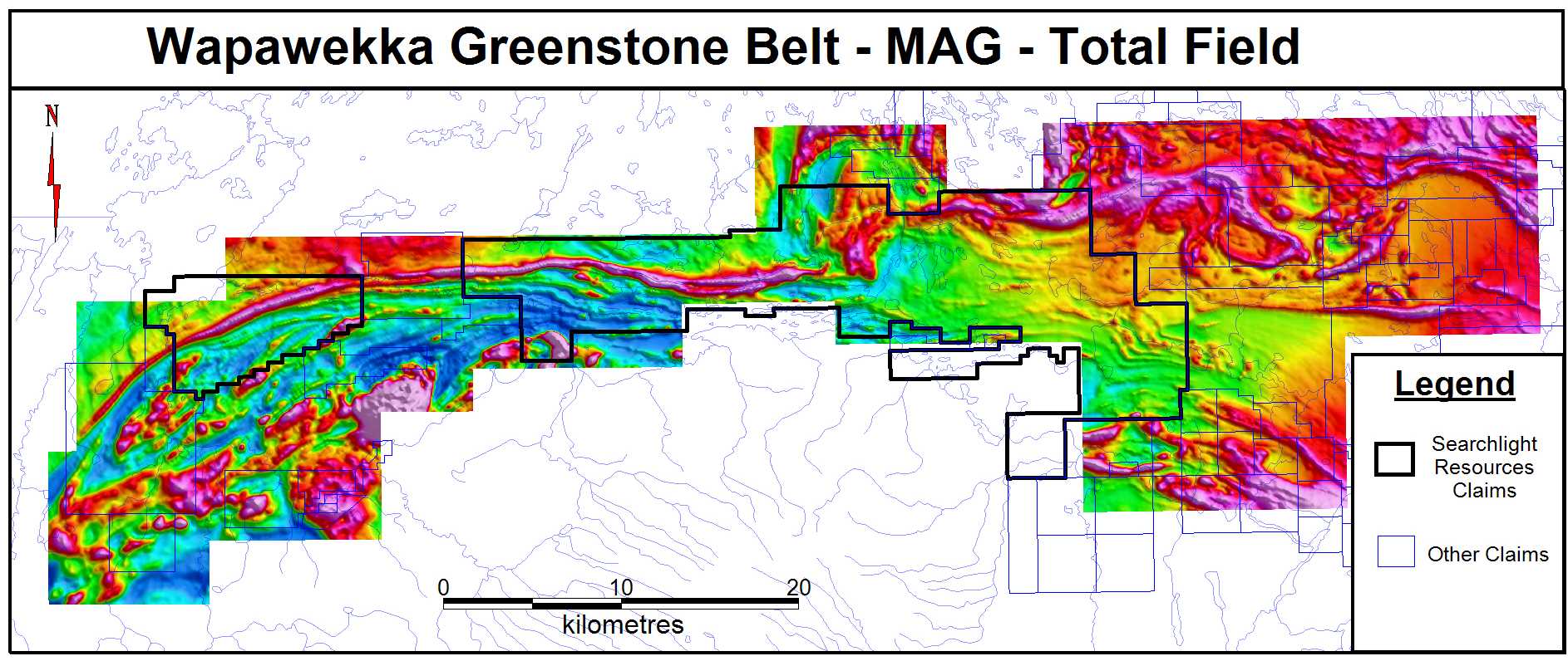
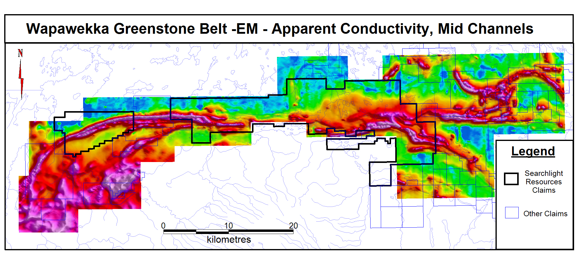
- 347.2 sq. km of new claims with gold and base metal targets
- Along a 60-km section of the Wapawekka Lake Greenstone Belt
- Staking based on recently flown Airborne Geophysics
On September 17th, 2020, the Government of Saskatchewan released a set of maps and raw data from the Southern Glennie airborne electromagnetic and magnetic surveys flown over an area 40 kilometres southeast of Lac La Ronge, Saskatchewan in early 2020. The helicopter-borne geophysical survey by Geotech Ltd. included Electromagnetics using the versatile time-domain electromagnetic (VTEM™ Max) system, and Aeromagnetics using a caesium magnetometer. The survey covers an area of 1,110 sq. km, with a total of 6,595 line-kilometres of data at 200-metre line spacing. (See maps below)
The survey was funded by the Government of Saskatchewan as part of its Mineral Development Strategy, with technical support for the survey provided by Natural Resources Canada (NRCan). The Wapawekka Lake Belt, as with much of Saskatchewan, is underexplored and has had only limited past exploration on its’ gold and base metal targets. The western end of the new Searchlight claims is road accessible, and approximately two thirds of the claims are boat accessible from Wapawekka Lake. The location of these new claims allows year-round exploration.